Airborne lidar
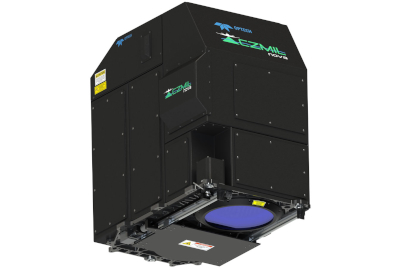
CZMIL Nova
The enhanced design and automated processing tools produce simultaneous high-resolution 3D data and imagery of the beach and shallow water seafloor, including coastal topography, bathymetry, benthic classification and water column characterization. CZMIL has been proven to outperform other bathymetric sensors in shallow, turbid waters, and CZMIL Nova improves on this with greater ease of use, smaller size, and less power consumption. Its bathymetric lidar is integrated with a hyperspectral imaging system and digital metric camera. Optech HydroFusion, a powerful end-to-end software suite, handles data from all three sensors—from mission planning to post- processing, delivering fused lidar and imagery datasets, bottom classifications, and even submerged object detection. Enhancements include CZMIL HydroFusion won the MAPPS Geospatial Products and Services Excellence Award for Technology Innovation.
Drop us a line
Request for Quote